Another cold, beautiful day.
 |
| Glenquey House |
The narrow Water Board road which gives access to Glenquey Reservoir as well as Glenquey House provides a pleasant approach to Innerdownie Hill, though it seems the more popular way nowadays is from Glen Sherup carpark which enables a route round the head of that glen to be made.
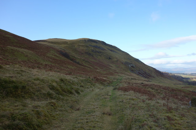
The track through the gate goes to Castle Campbell, a worthwhile walk, but today we were glad to turn right and follow the sunny track below Innerdownie. It is also possible to go straight up the hill from here and cut out a fair bit of walking, but we rarely do this now since it misses out a fine part of the ridge and a rather high gate has to be climbed.
 |
| Looking back towards Glenquey House (hidden) |
 |
| Our direction of travel |
Just before the path begins its descent to the hamlet of Burnfoot, we took to the steepish slopes after which the gently rising ridge goes straight to the fine summit cairn. Looking at the map one would think the walk is through dense woodland but this is far from the truth: this is Woodland Trust country and the native trees are well spaced as you would expect. The conifers seen in the picture below are another matter and provide dense cover on the Glen Sherup side though some harvesting has taken place recently.
 |
| At the start of the gently rising ridge. L is wearing Karrimor Lycra stretchy, warm fleecy leggings bought some 30 years ago when the Karrimor label meant something. I have a pair of black ones. Who needs new gear? |
 |
| A superfluous sign if ever there was one. There's now a seat further up. |
 |
| Foreground: Ben Shee above Glen Sherup |
The summit gives good views north, uplifting spirits, inspiring future plans.
The Ochils for all their benign appearance should not be underestimated. We have been turned back from summits in atrocious winter weather, usually because of deep snow and severe winds.
 |
| We turned back a few meters from the top on this occasion, in January 2016. The photograph does not do justice to the fierce conditions. |
Access to Whitewisp Hill by this route is blocked by a high deer fence with an equally (obviously) high stile over which, many, many years ago, I had to carry our Border Collie. Long after she'd sadly gone, a dog access door appeared in the fence and today we discovered a full size gate immediately to the right of stile. Quite a contrast with Sir Hugh's recent experiences at
www.conradwalks.blogspot.com
 |
| Between Innerdownie and Whitewisp near Bentie Knowe |
Descending Innerdownie on our way back two guys on mountain bikes came hurtling down behind us. They gave no warning - we just happened to hear them. We moved aside and they acknowledged the fact, but I feel sure that they regarded themselves as having right of way when they didn't. I find this increasingly irritating.
Note: I'm aware that this route has appeared several times on this blog but that's just how it is at this time of the year.
11 January. Wether Hill - some pictures
 |
| Lower Glen Devon Reservoir |
 |
| Summit area of Wether Hill looking towards Innerdownie Hill |
 |
| Looking north |
 |
| St Mungo's Well from the drove road - water supply for Gleneagles Estate |
 |
| Water purification building for St Mungo's Well water supply |


