Stuc a' Chroin and Ben Vorich

Stuc a' Chroin and Ben Vorich

Sunday 27 March 2016

Friday 25 March. Grahams - Meall Reamhar 620m NN922332 and Meall nan Caorach 623m NN928338. Map 52

It was yet another beautiful morning as we passed through the Sma' Glen to the pleasant hamlet of Amulree although half way there we realised that we'd forgotten the cameras. Yes, both of them. A week ago this would have been a minor disaster but I recently bought an iPhone 6s Plus so the day's photographic record was saved and all photos here were taken with it.

In past days, old military roads went north from Amulree to Aberfeldy, south to Crieff;  others went by Strathbraan to Dunkeld, and to Kenmore by Glen Quaich.

We parked opposite the now abandoned hotel - William Wordsworth and his sister Dorothy stopped here on Friday 9 September 1803 during their tour in Scotland, as Dorothy recorded in her journal: "We halted at a lonely inn at the foot of a steep barren moor, which we had to cross".

We on the other hand prepared to brave the traffic on the kilometre walk along the A822 to Girron, not realising that we could have parked at the start of the walk.

Click to enlarge all photos
From Girron the track headed over the hills between our two Grahams to Glen Almond but since we had a circuit in mind it was soon left for the hillside and our first objective of the day, Meall Reamhar.

Looking back to Amulree and Craig Hulich after leaving the track
The ridge easily gained, we followed the line of an electric fence which seemed to go all the way to our summit. We hoped sincerely that the cairn was on our side of the fence!


Meall Reamhar and left, our next objective, Meall nan Caorach

We were buffetted along this pleasant heathery ridge by a strong, cold westerly so taking photographs with the iPhone was no easy matter.


Meall Reamhar
A brief halt and our thoughts turned to our next hill across the glen. A hare, still white, darted across the hillside; a small group of other walkers were on the track below. I looked around taking in the view anticpating the rest of the day.


Meall nan Caorach from Meall Reamhar
Then I slipped, turned awkwardly and fell onto a small slab of rock face down, my ribs taking the full impact. Had I cracked a rib or two I wondered. Deep breaths were painful. A stop for some hot drinks and food seemed sensible before continuing. An ultra careful descent to the track followed and then, perhaps against our better judgement, we slowly began the climb to the top of Meall nan Caorach, with only the odd wimpish yelp of pain on the way.

Meall nan Caorach
Our original intention to traverse to Chreag Ghorm, a Graham Top was ditched in favour of regaining the track quickly, as my ribs (or something) were now well and truly hurting.

I'm sure we will return for this Top and maybe walk the track down to the River Almond at a later date.

Looking back to our two hills, Meall Reamhar right
Back at Amulree we had a look round the small church.


It was a peaceful place and we would have spent longer there were it not for my mishap.


Tuesday 22 March 2016

Sunday 20 March -Meall Buidhe 719m Graham. NN576275 Map 51

A glorious drive on a glorious day saw us at the car park at the summit of Glen Ogle. It could be argued that we had chosen too modest a hill given the weather and the array of snowy peaks available to us. However, Ben More, Stob Binnein, Ben Lawers etc are rightly popular hills, especially on a day such as this, so for seekers of solitude little Meall Buidhe had much to offer.

The track which leads to a mast goes through a conifer plantation, usually dark, dreary and silent places, but the sun shone directly between the trees and the birds were singing. Some way on, Lynne announced that she'd forgotten her waterproof. "I put it out for you. In the hall, by the chair". "Didn't see it". "Well, I put it out last night". "I never saw it" etc, etc. On many other days this year the absence of said waterproof would have been a problem.

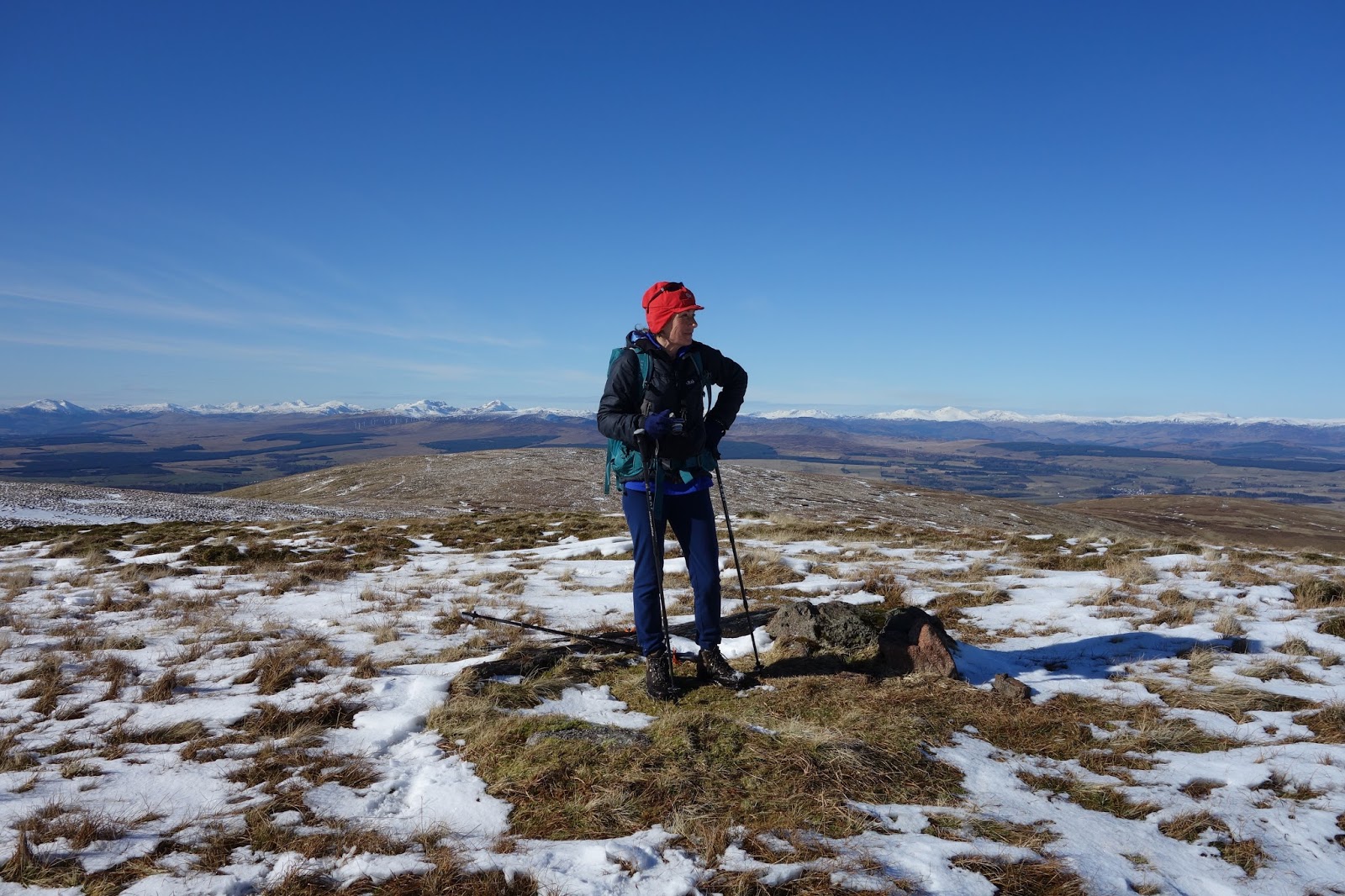
Waterproofs weren't going to be needed today. Ben More and Stob Binnein. Click to enlarge all photos.

Across Glen Ogle lay the Corbett, Craig Mac Ranaich while westwards Sgiath Chuil and Beinn Bhreac brought back memories, years apart. Ben Lui's centre gully was still complete and no doubt as avalanche prone as ever.

Zoom to Ben Lui
Shortly after breaking out of the trees we came across two newly born lambs, fresh placenta on the track. One struggled up, wobbled, then managed to follow mother into the long grass. The first lambs we've seen this year.

From the mast the way ahead was through thick heather over gently undulating terrain and soon the little cairn appeared with Vorlich and Stuc a' Chroin filling the view  across Loch Earn. A larger cairn a short distance south gave views over Glen Ogle and Lochearnhead. A tranquil scene it was.

From the large cairn

The summit cairn from the lage cairn overlooking Glen Ogle.
Below was a lovely spot for a long lunch. No hurry today. We lazed in the sun and talked, as we often do at such places, of exploits of the past and plans for the future.

Despite having done the Munros and almost the Corbetts we are no list tickers, but there is little doubt that seeking out hills because they are on a list has taken us to places that perhaps would not otherwise have been visited. Invariably, the effort has been amply rewarded and today was yet another example.

I seemed to be carrying an inordinately large pack today! Ben Vorlich and Stuc a' Chroin in distance

An easy walk took us over a few bumps to Beinn Leabhain which gave open views of the Lawers hills, Loch Tay and Killin.

On our way to Beinn Leabhain

Looking back to Meall Buidhe
Lawers, losing snow cover fast, and Loch Tay

Down we go

It appears that this is either our 28th or 29th Graham and we hope to explore many more this year. I have the feeling that because they are under 2500ft and unfrequented, the going will be rough - much rougher than most of the Munros. Now there's something to look forward to.

We arrived home and there in the hallway was .... the absence of a waterproof. A quick rumage in my sack and two waterproofs emerged........


Tuesday 15 March 2016

Monday 14 March - Beinn Dearg 706m.Graham NN696197. Graham Tops - Sron na Maoile 618m and Stuc na Cabaig (unratified 708m). Map 57

The drive to Comrie and then down Glen Artney was all pleasure on this perfect March morning. What a day to be setting out for the hills.

Getting ready. Click to enlarge all the photos.

A short walk back up the road from the car park to Dalchruin brought us beside the lovely Water of Ruchill and, fortunately, a bridge over it. After the ruin of Dalclathick Lodge the atv track became a quagmire so we took to the massive tussocks to head for our first Top of the day, Sron na Maoile (618m).

Dalchruin

Tussocks and looking towards Stuc na Cabaig (Graham Top)
It was hard going through this lot but as always, things improved. We heard what we thought was an atv in the distance but discovered, moments later, a shallow pool with frogs leaping into it as though on springs croaking their little hearts out.  Loads more joined the chorus from winter bleached grasses. 

Onwards and upwards, on easier terrain now, and the view we had been waiting for.

Stuc a' Chroin and Ben Vorlich

Deep hags separated us from Sron na Maoile but we found a way through remarkably easily. We were soon at the small cairn, pushing on quickly to cross the intervening summit of Sron nam Broighleag and so to the second Graham Top, Stuc na Cabaig. Apparently this Top may be the Graham, an unratified survey showing it to be 708m, some 2m higher than Beinn Dearg. We were therefore careful to stand on its summit!

It was difficult not to keep looking back

The ridge ahead to Beinn Dearg looked interesting, so off we set full of the joys of spring.

Beinn Dearg in the distance

In Knoydart you'd be thinking that some hard work was ahead, but here the ups and downs were gentle and the three subsiduary summits came and went with relative ease. The whole way was a delight, descending and ascending snow patches just for the fun of it.

On our way to Beinn Dearg

Beinn Dearg

It's possible from here to include another Graham, Mor Bheinn, but this involves climbing a deer fence which we didn't fancy at all, so we turned and dropped down into Coire Innein to find a spot for lunch.

Looking back to Stuc na Cabaig, centre

 We were a hungry pair like the deer below us. The name Glen Artney may be from Gleann-ard an-fheard meaning the high glen of the deer.


We came down on a golden afternoon to the sound of a curlew and glimpes of the Water of Ruchill. Crossing the Allt Coire Choire at the Ath na Meine ford brought us back to Dalclathick for a cup of tea and a Stoats Oat bar.

Uninhabited Dalclathick Lodge

Sheets of snowdrops lay below a deserted steading. We were reluctant to leave. But Mor Mheinn has still to be explored and climbed so it won't be long before we are back in this lovely glen.


Friday 11 March 2016

Monday 7 March 2016 - Blairdenon Hill 631m Donald - Map 58. NN865018


The day started badly. Arriving at Menstrie, the car park was full (all three spaces) and although we could easily park by the Scout Hut, I was inexplicably irritated by this minor inconvienence. As a result things got worse as we set off in the wrong direction up the wrong side of the Menstrie Burn. 'Humiliating' as Sir Hugh might say.  Arrival at the monstrous haul road which goes all the way to Sheriffmuir did little to lighten the mood. The sensible thing would have been to retrace our steps and get on the correct route, but this was no day for sensible decisions. On we went, a good view of The Kips crag providing a cheering sight.

Kips Crag taken near Menstrie - routes to VS
We fairly sped up the road  but there was nothing to be gained by following it too far so I decided to cross a fence and descend to the Menstrie Burn in the hope of finding a way across to the eastern bank. In contrast to the ugliness of the haul road, it was a beautiful scene with the sun catching the Menstrie Burn below; Lynne spotted a lovely woodcock. Going the wrong way can have its rewards. Crossing the burn was straightforward and a brief exploration revealed a gate in the newly erected deer fence.  A steep ascent, initially through huge tussocks (lack of grazing) led to a track which we followed back down to the First Inchna Burn and so to the route up to Colsnaur Hill.

Blairdenon Hill from Colsnaur Hill.

It was a pleasant climb to the cairn but much of the hillside on this eastern side of the Menstrie Glen has been planted with Sitka spruce and some 640ha of planting at Jerah Farm has now changed the character of this historical landscape. Permission for this development was given by Forestry Commission Scotland and was opposed by Friends of the Ochils, amongst others, but to no avail.

Colsnaur Hill summit cairn

A sunny hollow below the cairn provided the ideal spot for much needed sustenance and we had just settled down when another walker arrived.  He also had walked these hills since a lad and was trying to regain some fitness after surgery. It was a pleasant interlude with someone who obviously loved the Ochils and hills in general but this was as far as he was going today. We, despite being well behind schedule, still wanted to go out to Blairdenon.

The frozen gound made for rapid progress and thankfully Menstrie Moss was firm, if not solid, so we reached the short descent to the Old Wharry Burn dryshod.

Lynne on the summit. The cairn was bigger on my first ascent, I think. Maybe my memory is playing tricks
This area of the Ochils forms an extensive plateaux with superb views of the southern Highlands, still retaining a significant snow cover. Between Blairdenon and Greenforet Hill a small memorial cross marks the spot were a  civilian DH 82 Tiger Moth crashed in 1957.

A few photographs and we retraced our steps back to Colsnaur Hill.

Descending to the Old Wharry Burn with Colsnaur Hill in distance

Bengengie Hill (R), Ben Cleuch (Centre) and Ben Buck
Some of the plantings seen from the lower slopes of Colsnaur HIll

Blue shows way out and red line the last part of the route back
We sauntered down the track back to the car in the spring sunshine happy to have enjoyed such a glorious and varied (!) day.


Tuesday 8 March 2016

Friday 26 February - Lendrick Hill 456m Marilyn - Map 58 NO019036

Inevitably, the crisp clear weather of the previous few days came to an end.


Never mind, we had a leisurely morning before driving the short distance down the Dunning Glen road to the small parking spot below Lendrick Hill. We've climbed it twice before, once by the dull gloomy firebreak through the conifers (the title 'Lendrick Forest' gives the game away) although the trees weren't as high as now, and once in winter by the edge of the forest. This route is to be preferred and was our way today.

I've never found the summit environs to be particularly pleasing, even under snow but I can't say why. Perhaps it's because there is no obvious continuation to other tops. It is possible, as we did on our first ascent, to drop down to South Queich and climb Braughty Hill continuing over Nether Town Hill to Mellock Hill, but that cannot be described as a 'natural continuation'.

However, we enjoyed today's short outing and once down on the forest track we enjoyed the bonus of lunch in the sunshine.

Trig on Lendrick - Lynne checks that our village is still there

Since then we've had some lovely weather although I haven't posted yet more about the Ochils.

Yesterday we went out to lonely Blairdenon Hill in glorious weather and a post will follow.

Note: all photographs can be enlarged by clicking.