
Corb. 1428 'Crob'. Derivation for this form 'compare Gaelic 'Crob', later 'Crobh', a hand, a claw, possibly referring here to some perceived shape in the terrain. For instance the contours on the north side of Corb Law on OS maps trace the shape of a hand with outstretched thumb and clenched fingers (Angus Watson, The Ochils, Placenames, History, Tradition).
He's correct of course, but we had no knowledge of this when setting out for Corb Glen and Law. Watson does point out that the hand shape is not easy to see on the ground and the reference may be a 'tantalising coincidence'. We need to go back.
A locked gate, the top festooned with barbed wire, gave the distinct impression that walkers were not welcome. We squeezed through a gap with me taking extra care not to catch my brand new ME Lhotse jacket and headed into the cold, raw, wind. A short distance up the track and yet another barbed gate appeared but at least this one opened. We had been in the Glen many years ago dropping off John's Hill but had never approached from the delightful B934 to Dunning although we've used it to access other hills in the area.
Around this point we left the track for Corb Hill, an easy ascent over the usual tussocky Ochils ground but again barbed wire covered the top of an old wooden fence which we had to cross. It was cold and the strong wind battered us as we followed the fence northwards. We're not fans of walks where at some arbitrary point we turn round and retrace our steps, but today that's exactly what happened. Black Hill of Kippen, a vague objective initially, seemed hardly worth a visit so once the view north opened up, we hurried back to Corb Law and downwards for some lunch.
Our day out having been thus shortened, Lynne suggested we wander through the Glen to the point above Coulshill Farm where the RoW from Glendevon to Auchterarder descends to meet our route.
We went no further and enjoyed a leisurely stroll back to the car. Somewhere along the way, I lost my sit mat.
Not a good day for photos but click to enlarge if you wish.
He's correct of course, but we had no knowledge of this when setting out for Corb Glen and Law. Watson does point out that the hand shape is not easy to see on the ground and the reference may be a 'tantalising coincidence'. We need to go back.
 |
| Can you see the hand? |
A locked gate, the top festooned with barbed wire, gave the distinct impression that walkers were not welcome. We squeezed through a gap with me taking extra care not to catch my brand new ME Lhotse jacket and headed into the cold, raw, wind. A short distance up the track and yet another barbed gate appeared but at least this one opened. We had been in the Glen many years ago dropping off John's Hill but had never approached from the delightful B934 to Dunning although we've used it to access other hills in the area.
 |
| Barbed gate number two and Corb Law |
 |
| The steepish slopes of Corb Law and John's Hill (left) form Corb Glen |
Around this point we left the track for Corb Hill, an easy ascent over the usual tussocky Ochils ground but again barbed wire covered the top of an old wooden fence which we had to cross. It was cold and the strong wind battered us as we followed the fence northwards. We're not fans of walks where at some arbitrary point we turn round and retrace our steps, but today that's exactly what happened. Black Hill of Kippen, a vague objective initially, seemed hardly worth a visit so once the view north opened up, we hurried back to Corb Law and downwards for some lunch.
Our day out having been thus shortened, Lynne suggested we wander through the Glen to the point above Coulshill Farm where the RoW from Glendevon to Auchterarder descends to meet our route.
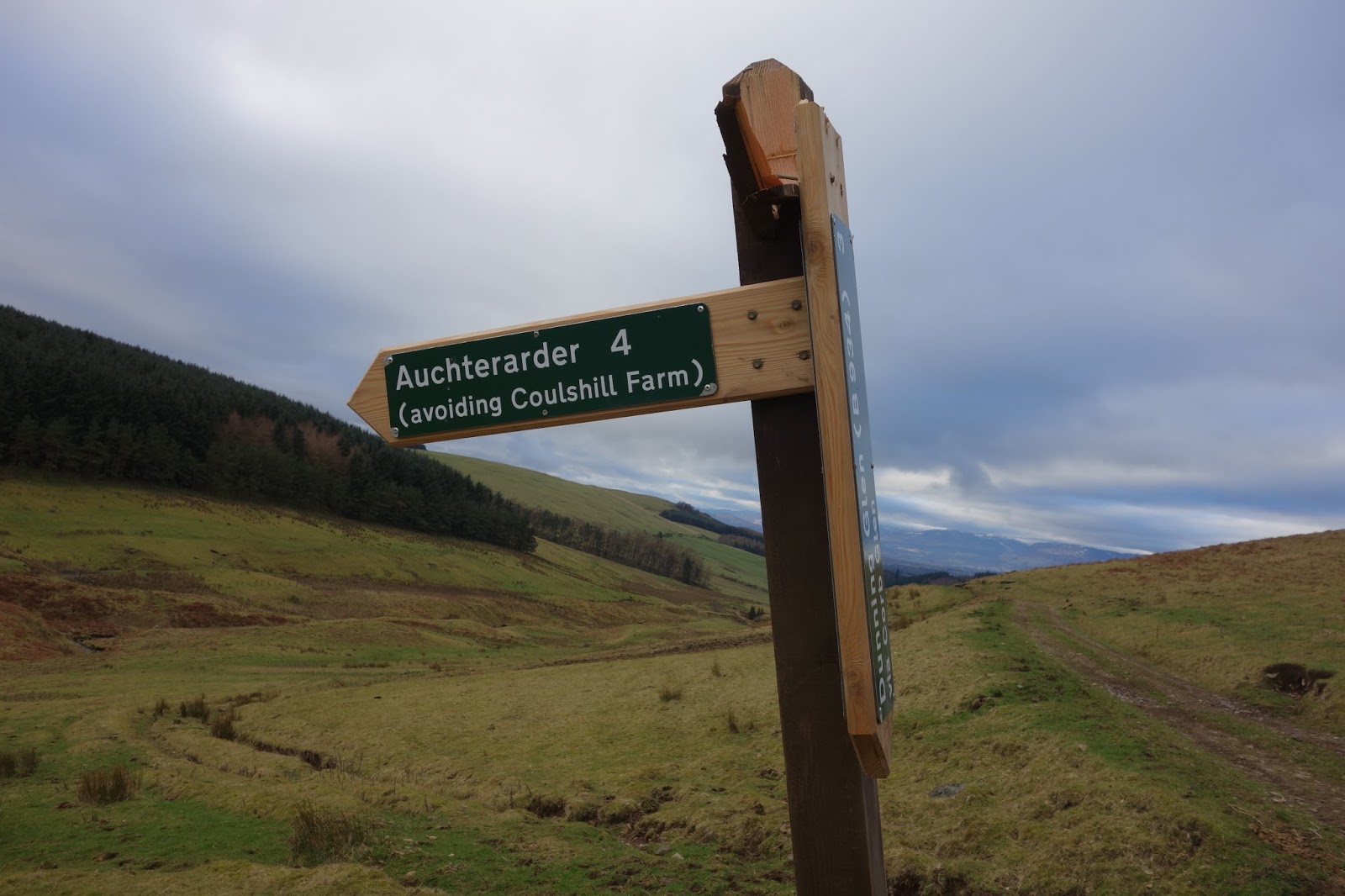 |
| The new sign was damaged. Note the 'avoiding Coulshill Farm'. |
 |
| I suspect this was damaged on purpose. Perhaps more evidence of hostility to walkers. Note the ghastly Greenknowes Windfarm |
We went no further and enjoyed a leisurely stroll back to the car. Somewhere along the way, I lost my sit mat.
Not a good day for photos but click to enlarge if you wish.
 |
| A circuit would have given a slightly longer day |


